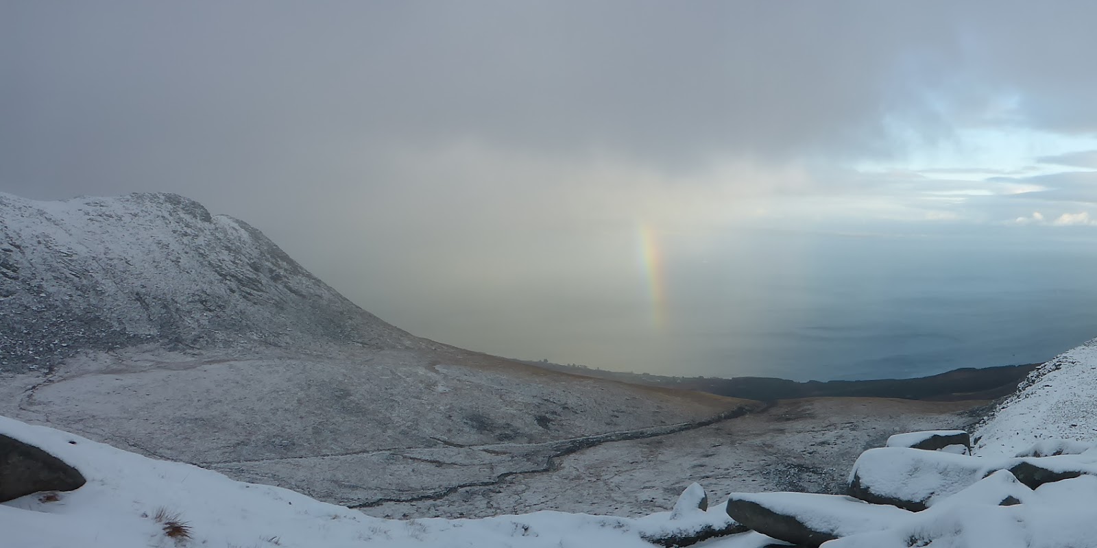
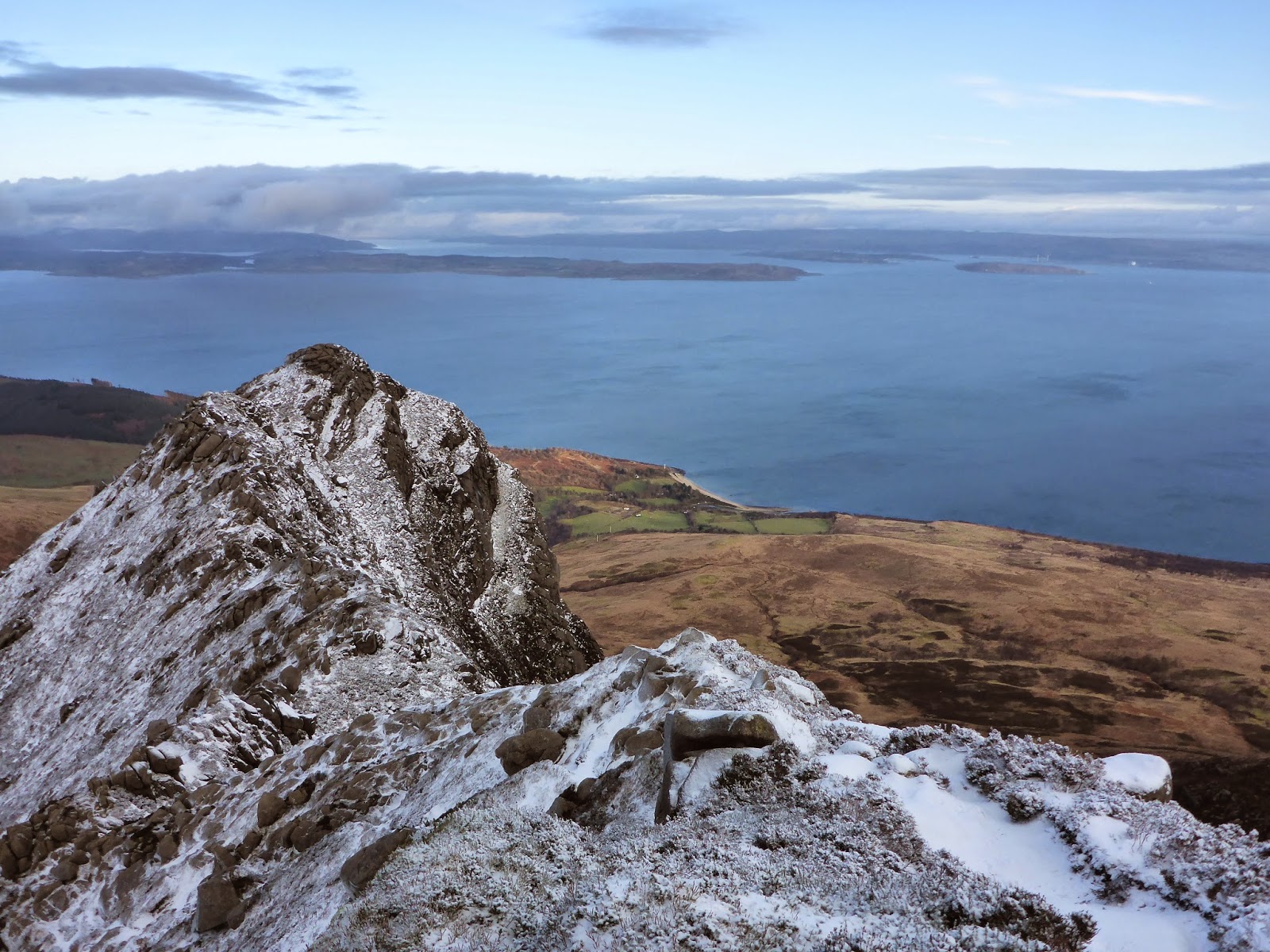
This isn't going to be a short blog post- but I promise that it will contain more than lots of pictures of trigpoints and complaints about my feet. First of all the important bit- I did this to raise cash for two special causes- my local MRT, Arran Mountain Rescue, who are funded largely by charititable donations from the public, and the team on Mulanje, Malawi, who have very little in the way of gear or funding at all. As I write, there is still time to donate- please click here and donate if you enjoy my story:
http://www.gofundme.com/Arran_Trigs
 |
| The journey begins! |
The challenge I set myself was to link all 17 of Arran's pillar trigs, in a single unsupported push, taking in the destroyed blocks of Sannox and bolts of Corrie and Caisteal Abhail just for fun- 23 points in total. I calculated that it would be around 120km- and it was exactly that- 120km of bog, mountain, forest and heathery hill. Mostly this was pathless country, but I took in a brutal section of tarmac in the south end to catch up on some lost kms.
Day 1:
http://my.viewranger.com/route/details/NjIxNzk=
I set out from Catacol later than planned but buzzing. The pack felt heavyish but ok and the slopes of Cnoc Leacainn Duibhe were steep but gave way before me. It wasn't long before I was triumphantly leaning my pack against pillar no 1 and updating Twitter. Soon I was striding purposefully through Lochranza and waving cheerily at everyone I passed. Bring on the challenge!
Things got tougher above Laggan. It was windy on the ridge- really windy. Near the Laggan trig I
 |
| No 1: Cnoc Leacainn Duibhe |
stopped for a snack- put my pack down, and the wind snatched my map from the side pocket. I chased it briefly, and then watched it cartwheel over the edge of the seaward cliffs. Disaster!
Who does a trig point challenge without a map? Come to think of it, who does one without a spare?
Me apparently.
I headed onward, grateful to Viewranger mapping on my phone (musing that I might be about to become a statistic- a foolish hillwalker caught navigating with just their smartphone). I was totally phased by this, and spent ages searching the cliff edge at Crogan for the North and South blocks- forgetting that they were listed as destroyed. Giving up eventually, the North Sannox Pillar came in to view and I headed down in to the woods past another destroyed trig- the Middle Transit. I sent a text to Wally, feeling deflated by my lost map and failure to find the Crogan blocks.
 |
| North Sannox... still smiling. |
Pushing on, I said hello quickly to the destroyed block by the navigation beacon in Sannox, and strode down the road to Corrie. Wally met me by the Corrie bolt with a new map. I promised not to use it so that the expedition would remain officially "unsupported". He waved me on towards Maol Donn and Goatfell- where gloomy clouds were gathering.
Maol Donn was a bit of a slog across the bog- at the time I thought it was hard fought and won, but with hindsight I had it easy. I made good progress up Goatfell, but the weather deteriorated with altitude, and I began to realise that getting off and finding a safe campsite would be difficult. In planning, I'd known this would be the main hazard of the expedition, and I'd assumed that at the time I'd make a sound judgement based on the conditions (mine and the weather) about my onward journey. Instead I ignored the signs and pushed on regardless.
It's an endurance test right? So I will endure.
 |
| Goatfell summit |
Finding the safe path off Stacach was not easy. I've done it dozens of times, but in failing light with sideways hail and poor visibility, coupled with my scrambled head, I picked the wrong gully. Soon I was descending choss above a mossy slab.
This isn't right...
Not right at all.
Suddenly I realised how close I was to actually becoming a statistic. A messy one that my own MRT would have to deal with.
Not good. Sorry everyone.
I climbed back up to the ridge, where the wind was too strong to stand, and crawled on all fours until I found a better looking gully that turned out to be the right one.
I avoided North Goatfell to stay out of the wind, and cut back underneath and then up again to the
 |
| One word: grim! |
ridge to pick up the descent to the Saddle. Here the path is also not always obvious, with plenty of scrambling. It's borderline gnarly for a walk in good weather and with a light pack.... That night I was catching the full force of the wind and rain. At one point I got my rucksack wedged in a chimney. I had to unbuckle it and escape before trying to retrieve it without pulling myself off at the same time.
The Saddle didn't arrive soon enough. I'd always planned to camp here, but had considered whether it would be more sensible to continue in to Glen Rosa to find shelter. However, when I arrived, compared to the ridge, it seemed pretty calm, and I was exhausted so I pitched my tent and got dinner on.
Day 2: http://my.viewranger.com/route/details/NjIxODA=
Through the night, every half hour or so, a big gust of wind would rattle the tent and wake me up. After a while I tuned in to the telltale sounds of it roaring up Glen Rosa to meet me, and I'd be awake before it hit. My scrappy sleep continued until shortly before 5am, when all hell broke loose. Me and all my gear were soaked through and with my back hunched against the wall of the tent, I contemplated my options. I only had one.
Not long after I was high on Cir Mhor recovering in the shelter of steep craggy slopes and counting my blessings. The early start had given me extra time for what was to be a long day. Lack of sleep?
Piffle. Endure.
 |
| Abhail- A wee bolt for a big lovely mountain. |
Caisteal Abhail was quite a big detour for what is only a small bolt- but it was the Abhail bolt that made me want to include bolts at all- it's a fabulous summit. That morning there wasn't much to see, but I was surprisingly content to be there. I descended via the Leac an Tobair until I hit the 350m contour line and traversed north, past the Loch Na Davie outflow and all the way around the other side of Glen Iorsa, eventually descending towards Loch Tanna. This was a first for me, in ten years of living on this lovely island I'd never been to this loch- which is beautiful by all accounts, although I did not see it at its best. The mists swirled in and out, giving me glimpses of the slopes of Beinn Bharrain above. Bharrain is the only place on Arran where you will find true scree- and it makes up for the lack elsewhere. More akin to the Paps of Jura than the other Arran hills, its a tottering pile of stones. I ascended an eroded gully to Bealach an Fharaidh. Yes- the map came out.
 |
| More grimness. |
The expedition was no longer officially unsupported. The trig is on the main summit- Mullach Buidhe, in the middle of the ridge. Up there the wind howled and the rain ripped through my (not currently) waterproofs and soaked me to my already soaked skin. Wearing all my clothes, I was shivering and my thoughts were sluggish. I realised I was once more close to becoming a statistic and descended as fast as I could.
Below, a new day was emerging from the wet one that had gone before. The clouds rolled back to reveal a clean and golden world of
Molinia white grass and blue lochains. I stumbled headlong through the tussocks in to Glen Iorsa. After wading the river, I spread my dripping gear out on a gravel bank and let the sun do it's work.
 |
| The clouds roll back. |
The last part of the day was a hazy stomp through bog and grass. I marvelled at the strength in my legs (
am I really this strong?) as I climbed out of the glen to the plateau beneath Beinn Nuis. The Monyquil trig lurks at the edge of woodland, and I cooked my dinner there in the shelter of the trees. I then battered out a tedius arc through peat hags to maintain the high ground on to An Tunna, before descending quickly to a comfortable camp by the Machrie water.
Day 3
http://my.viewranger.com/route/details/NjIxODE=
I allowed myself a little lie in but was still moving by 7.30 am. The sun was shining on the dark slopes of Ard Bheinn and I was keen to get going. An old trackway leads to the edge of the forest in Glen Craigag. It wasn't far from here to the
 |
| Working up a sweat on Ard Bheinn |
summit trig, but here I encountered the deepest heather I've ever known, towering to head height on the steep slopes above the river. This slowed me down, like wading through treacle- the kind that
grabs at you and knocks you over, but it was early in the day, my legs felt ok, so I plugged in my ipod and treated it like a workout. Soon I was singing as I worked, confident that nobody except the wildlife could hear me. After a while I arrived at the trig, and before me lay the sea. I'd dreamt that this would be a fun day, with beach walks and flat paths. I couldn't wait get down.
At the road I met my mum, who walked and talked with me a while. Eventually she left my side and I joined the Kings Cave path that took me close to Tor Righ Mor. It was weird seeing holiday makers, who looked and smelled clean and happy.
I realised as I continued to the coast that I had a problem. Water. Or lack of it. The burns on the Tor were dry, and here at the coast the streams were dank and full of farmy stuff. In Blackwaterfoot I was forced to stop to buy 1.5 litres bottled water. I hoped I'd find some more later. I took the opportunity to buy an ice cream too. Cheating? Possibly.
 |
| Oh I do like to be beside the seaside! |
From Blackwaterfoot I took the coast path to just beyond Kilpatrick. I joined the road and found the corner of the forest that leads up to Cnocan Don. I'd expected another heathery stumble- but there- a gorgeous path led up hill in exactly the direction I wanted to take. Further up, I noted funny wooden bridges over boulders.
Pour moi? In case I don't want to scramble? Why, thank you! I finally realised that this was not for my benefit, but rather two wheeled fun, although it hadn't been used in months and I couldn't decide if this was for motorised or person-powered bikes. From the trig, it was straight down the hill to the road again, a quick and nervous hop over an electric fence, and on to Corriecravie.
I attempted to walk the coastal path, but it was stony, boggy and peppered with scary looking cows. I was beaten- the tarmac above called me. I apologised to my feet and hit the road after 1 km. From here I pounded tarmac at a solid 4km an hour. A proper pace at last. My feet got hot, and my head was sore. I ran out of water, but after a few kms was able to fill up again at Kilmory Village Hall. Evening drew in and it began to rain. I'd planned to camp at my final trig for the day- on Kilbride Hill, but
 |
| No camping! |
found it to be a quagmire of slurry and animal poached mud. I pressed on. The rain fell harder. Wally was planning to meet me with vital information about my route through the forest the following day. He was nowhere to be seen. My blood sugar dropped... the rain persisted. I howled at nobody, and then when I got him on the phone, I howled at Wally.
Wally was way back on the road- surprised by my progress, he was still searching for me in the van near Kilmory. He eventually caught up with me close to the Eas Mor track up to Garbad. We pitched my tent in the rain and darkness on a pocket sized patch of grass by the track and I stole a hot drink in the van.
Day 4:
http://my.viewranger.com/route/details/NjIxNzg=
My feet were blistered, but I'd convinced myself I only had 20km to go (
wrong!), so I was optimistic when I set off for the Garbad trig. Armed with essential info about the maze of forest and firebreaks I was entering (thank you Wally for seeking out my route), I found it lurking in a
 |
| Spooky wood... |
Tolkeinesque Mirkwood of lichens and hanging branches. It glowed white in the gloaming like a thing possessed. Onwards, left and right, zigzagging through the firebreaks, then pushing through the trees, until I popped out above Glenashdale, to sunshine and views of Holy Isle. Almost home!
From Glenashdale I was on turf I knew for a while, and thought that I'd have no problems pushing on up to Tighvein, the highest point on Arran's South End.
Wrong again! It's different with tired legs, blisters and a heavy pack. At less than 2kmph the going was tedious beyond measure. Heathery banks, dense willow thickets and reedy riverbeds barred my way. I received a couple of impatient texts from my mum- who was waiting for me much further down the road. Morale dipped. I howled
 |
| Tighvein. The middle of nowhere. |
again- roared even, but nobody heard me. I reached the summit, and descended to the Ross Road, knowing that there was worse to come.
Looking at the map- I could see that the 2km over the moor to Tighvein was nothing compared to the 6km to the Sheeans. I prepared myself, ate as much as I could and plugged the ipod in. I set my face against the rain showers that were rolling by and tried not to think about the end. I tried not to think about anything except one foot in front of the other.
This is what I do. Walk.
I must have picked up the pace because I arrived at the Sheeans an hour earlier than I'd expected. Food is wonderful and so is music. I'd only been there once before- nearly ten years ago- and then a path had existed that cut down to the forest road above Cnoc na Dail. I could see from the summit that much had changed since then- with felling, wind blow and new trees all over the place.
Damn.
 |
| Not my happy face. |
I made the best of it and set off in roughly the direction I wanted to go in. I picked a forest ride, and met a seemingly blind mass of windblow and new trees. I turned right in to an open ride, which got wetter as I traversed the hill. The wetness grew, from waterlooged to sucking bog. Soon I was trapped, both legs squelching above the knee. I kicked, frightened, and initially nothing happened. With a mighty heave I pulled myself free, and retreated in to the cover of the forest floor under low branches.
Damn. I scabbled under the trees alongside the ride until I saw heather growing in the light. A good dry plant, this might work. I emerged from the trees and continued, but before long I was back in the mire. Only this time I was really stuck. I pulled at the bog and it pulled back. I sank further. Up to my thighs. I remembered that wild animals die in bogs like this. More howling. Was I about to be another statistic? I felt the mud yanking at my boot.
Oh no! But then-
oh yes,
it can have my boot but it can't have me.
I recalled reading somewhere about how to escape quicksand. Like steering in to a skid- you break the suction by pushing against it's force. I kicked, I squelched, and I rolled free, with both my boots still attached to my feet.
Cowering in the forest. I texted Wally my grid reference so he would know where to look for me if I never made it out. I really had hit a low! I considered my options once more and again I only had one. I crawled back in the direction I had come to reach the first ride where my way had been blocked by timber and fresh spiky young sitka spruce. Pushing my way through it was the only way. It wasn't long before my knuckles were bleeding, but I made progress. I saw light to the right, and a glint of something man made. More scrabbling through trees, and I broke out on to a quad track that led me straight to the forest road.
One more to go- It's in the bag!
Crossing tarmac for the second time that day, I was suddenly surrounded by loved ones. Wally, my mum and her husband Alan plus happy waggy dogs were walking beside me.
I ought to feel happy but all I feel is sore.
 |
| Finally there- with Wally and Mum (Sue Weaver). |
As I approached the final trig point at Clauchlands I tried to think of the people I did it for. I mainly did it for the men on the mountain in Malawi who don't have proper walking boots or waterproofs but who will come looking for you in a storm at 2500m if you need them. I also did it for my local mountain rescue team who have all the trappings of a first class emergency service, but who are really volunteers funded by donations. I'm a part of this team, and very proud of this fact- there are some tough, good people there who will get you out of a fix if you need them. I also did it, truth be told, to find out if I'm made of anything remotely similar to these mountain heroes. Having done it, I'm not sure if my mind is all that strong, but it turns out that my legs are.